Dry run by satellite
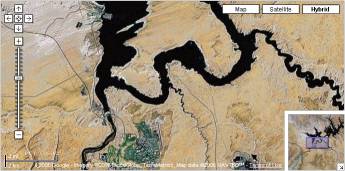
Touring with Google maps. Now since the first cut of the tour was done, I did a dry run by using Google Maps in Satellite mode. This was a lengthy but fascinating experience. I put the zoom so that I still could easily identify little villages but high up enough to see the surrounding scenery. Most of the time I "flew" in hybrid mode to easily follow the roads. Lot of aha effects: Oh Pyramid lake isn't that far off - let's do a detour. Wow driving through South Dakota is a real stretch. Ahh - now we come into Wisconsin - hey this is a much more dense population than we thought. Didn't realize how close New York is from Philadelphia - we may as well drive up there for a day. Now I see what people mean when they talk about the Blue Mountains in Virginia - but it is a long long windy road. Not sure we can do it on that trip. I can go on and on. But this was one of the most helpful exercises in planning that tour, in particular when I came to the end of the trip in Arizona, Utah, Nevada and it's National Parks. Even so I have been there twice there are little villages I just missed and wouldn't know how big they are if not for the satellite view.


Comments